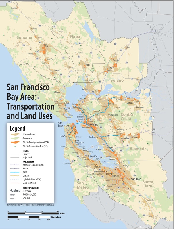
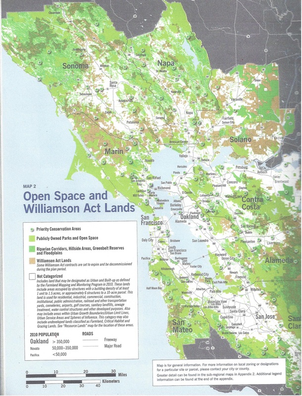
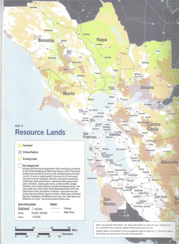
plan bay area maps
san francisco bay area
_____________________________________________________________________
SONOMA COUNTY maps
on google earth
the maps below were scanned from the original documents
To see the maps more clearly and up-close
we highly recommend viewing maps using google earth
Maps for locating Sonoma County Priority Conservation Areas (PCA's) and Priority Development Areas (PDA's) can also be found on Google Earth: http://gis.abag.ca.gov/gisdata.html
_____________________________________________________________________
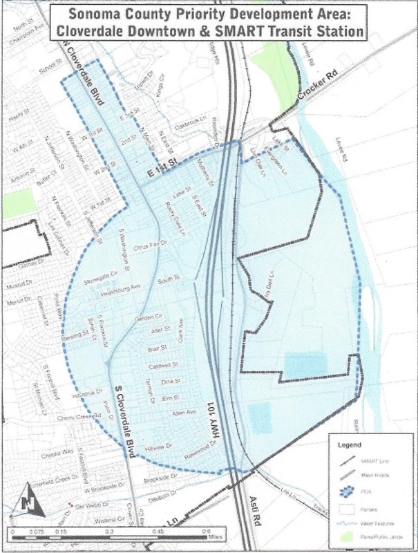
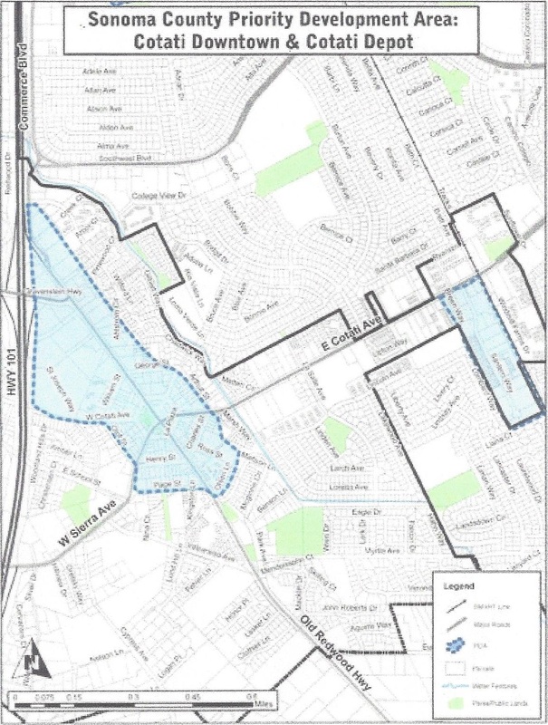
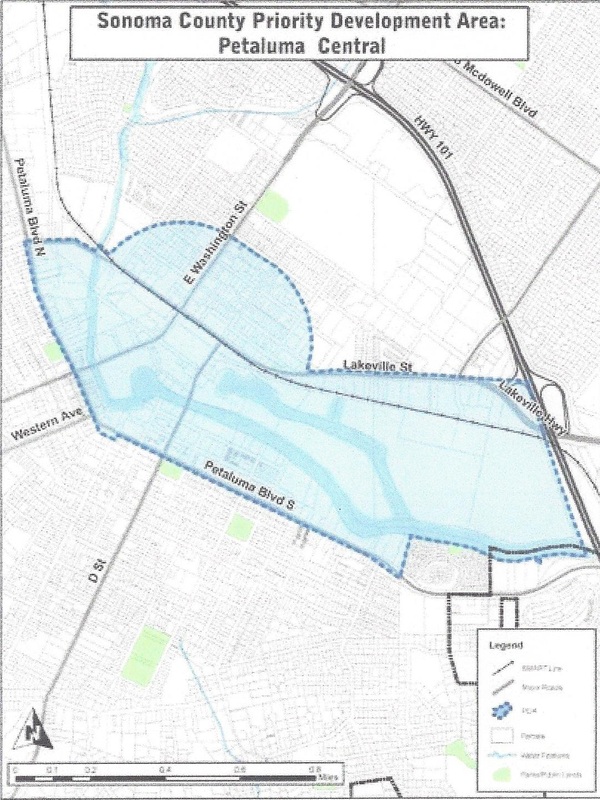
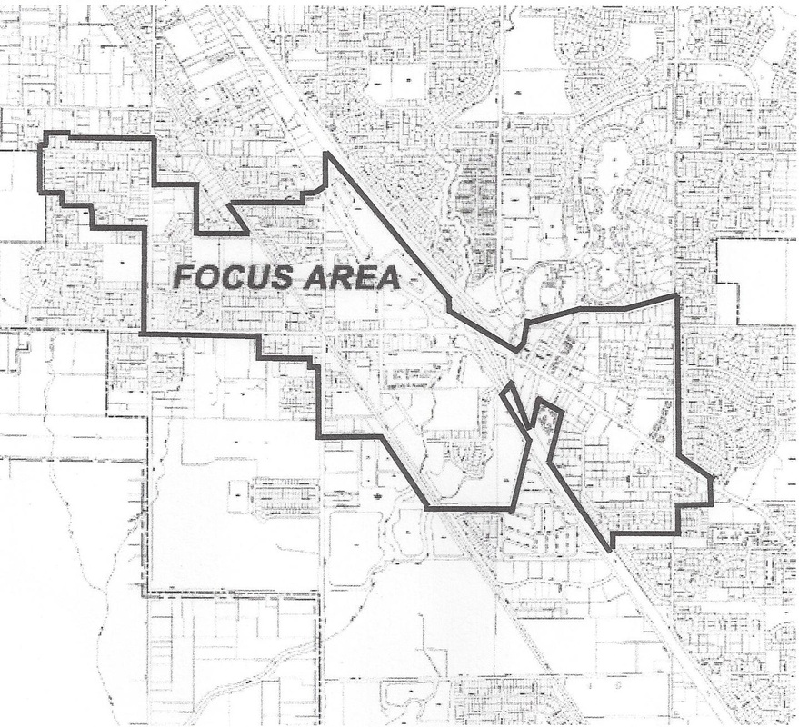
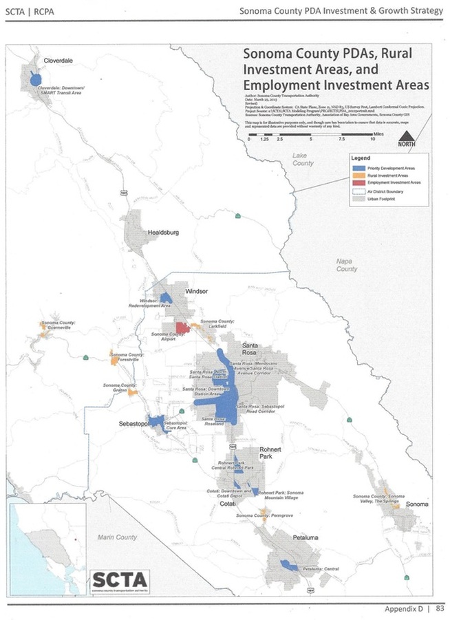
sonoma county
PRIORITY DEVELOPMENT AREAS (pda's)
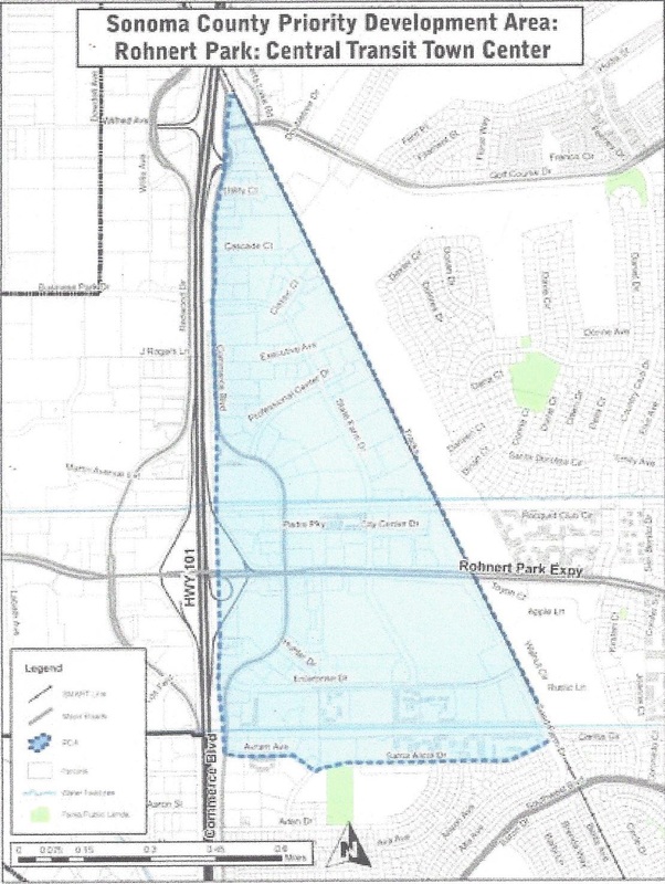
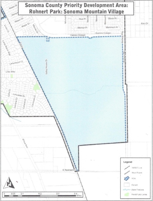
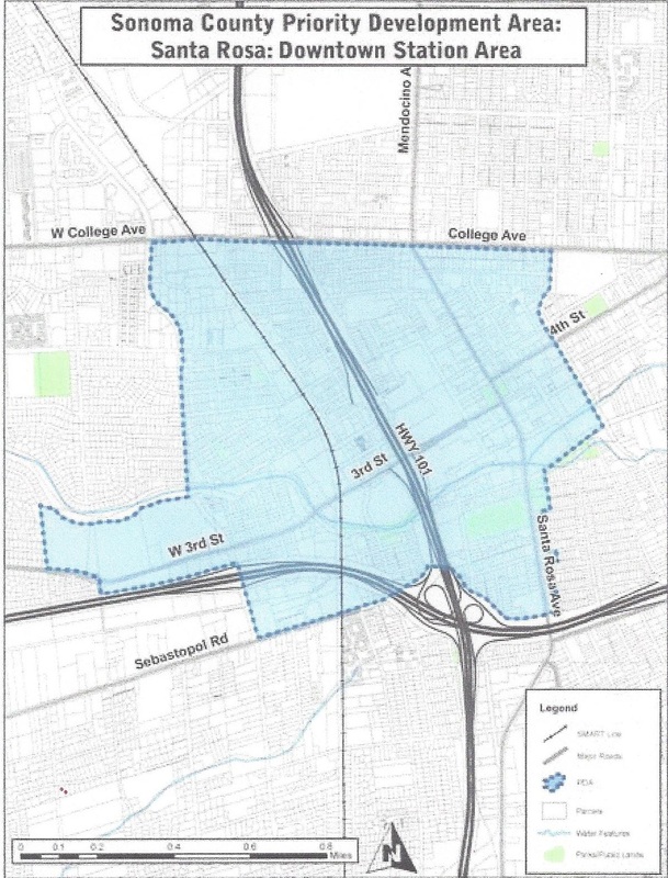
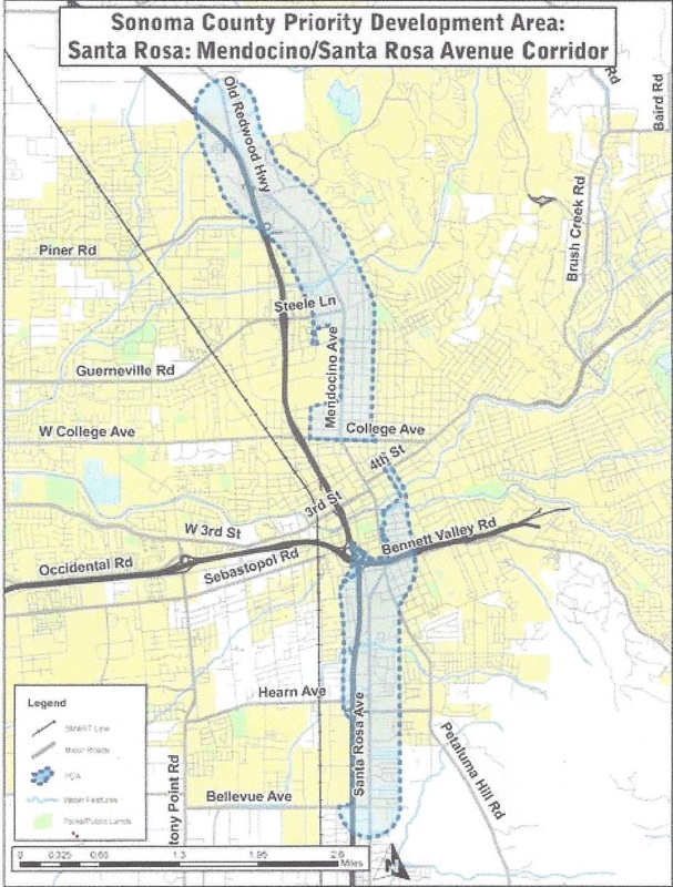
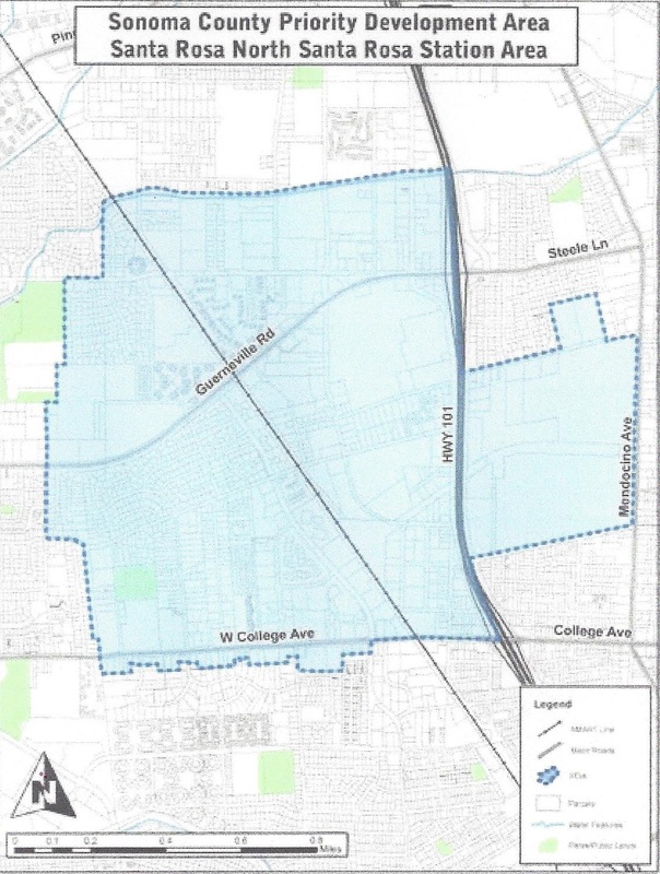
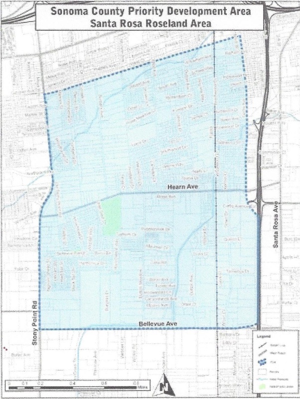
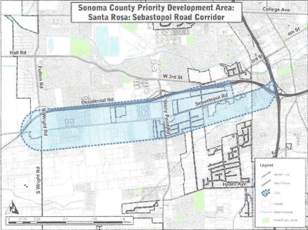
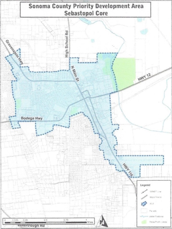
The following maps are from the Sonoma County Priority Development Area Investment and Growth Strategy Short Term Report, by the Sonoma County Transportation Authority and the Regional Climate Protection Agency on April 8, 2013.
To go to The Sonoma County Transportation Authority website: http://www.sctainfo.org/reports/Sonoma_County_Priority_Development_Area_Investment_and_Growth_Strategy_Short_Term_Report/Sonoma_County_Priority_Development_Area_Investment_and_Growth_Strategy_Short_Term_Report.pdf
To go to The Sonoma County Transportation Authority website: http://www.sctainfo.org/reports/Sonoma_County_Priority_Development_Area_Investment_and_Growth_Strategy_Short_Term_Report/Sonoma_County_Priority_Development_Area_Investment_and_Growth_Strategy_Short_Term_Report.pdf
cloverdale
cotati
petaluma
rohnert park
Santa Rosa
sebastopol
windsor
sonoma county
_____________________________________________________________________
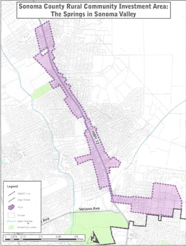
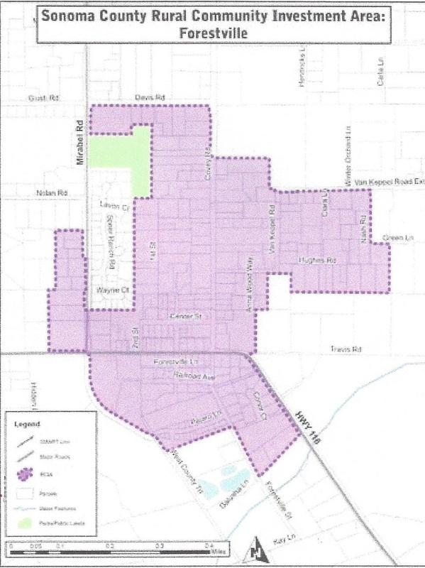
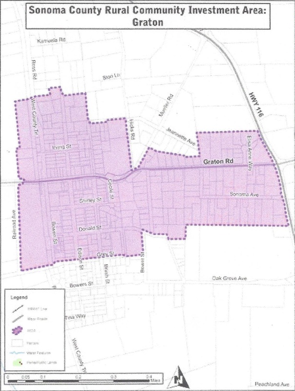
rural community investment areas
Forestville
Graton
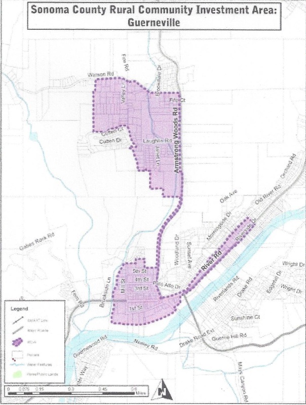
guerneville
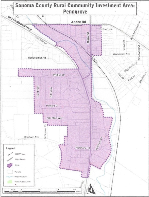
penngrove
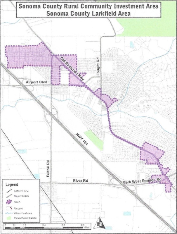
sonoma county Larkfield area
the springs in sonoma valley