WHAT IS PLAN BAY AREA?
The following information comes directly from the Plan Bay Area website and links have been included for your convenience.
Plan Bay Area is a long-range integrated transportation and land-use/housing strategy through 2040 for the San Francisco Bay Area. On July 18, 2013, the Plan was jointly approved by the Association of Bay Area Governments (ABAG) Executive Board and by the Metropolitan Transportation Commission (MTC). The Plan includes the region’s Sustainable Communities Strategy and the 2040 Regional Transportation Plan and represents the next iteration of a planning process that has been in place for decades.
Plan Bay Area marks the nine-county region’s first long-range plan to meet the requirements of California’s landmark 2008 Senate Bill 375, which calls on each of the state’s 18 metropolitan areas to develop a Sustainable Communities Strategy to accommodate future population growth and reduce greenhouse gas emissions from cars and light trucks. Working in collaboration with cities and counties, the Plan advances initiatives to expand housing and transportation choices, create healthier communities, and build a stronger regional economy.
“Plan Bay Area is an historic and important step forward for our region,” explained Napa County Supervisor Mark Luce, who also serves as President of the ABAG Executive Board and as an MTC Commissioner. “It’s the product of more than three years of collaboration between cities and counties to do our part to create a more sustainable Bay Area for current and future generations.”
Noting that Plan Bay Area is the successor to Transportation 2035, the long-range plan adopted by MTC in 2009, Commission Chair and Orinda Mayor Amy Rein Worth described the new plan as evolutionary rather than revolutionary. “For decades, MTC has been charged by state and federal law to produce a long-term regional transportation plan, while ABAG has been responsible for assessing regional housing needs. Plan Bay Area puts these elements together in a way that makes sense.”
Projecting a healthy regional economy, the Plan anticipates that the Bay Area’s population will grow from about 7 million today to some 9 million by 2040. “Maintaining our region’s high quality of life,” continued Worth, “will depend on making wise decisions about transportation, housing and land use.”
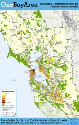
Plan Bay Area provides a strategy for meeting 80 percent of the region’s future housing needs in Priority Development Areas (PDAs). These are neighborhoods within walking distance of frequent transit service, offering a wide variety of housing options, and featuring amenities such as grocery stores, community centers, and restaurants. Identified by cities and towns across the region, the PDAs range from regional centers like downtown San Jose to suburban centers like Walnut Creek’s West Downtown area, and smaller town centers such as the Suisun City Waterfront. The Plan funds mixed-income housing production and locally-led planning in PDAs.
Plan Bay Area’s transportation element specifies how some $292 billion in anticipated federal, state and local funds will be spent through 2040. Nearly 87 percent (or $253 billion) will be used to maintain and operate the transportation network we already have. Another way of looking at the distribution of the revenues — which include fuel taxes, public transit fares, bridge tolls, property taxes and dedicated sales taxes — is by mode of transportation. Maintenance and operation of the Bay Area’s existing public transit services will receive about 54 percent ($159 billion) of the revenues. The remainder includes 32 percent for street, road, highway and bridge maintenance; 7 percent for transit expansion; and 5 percent for roadway and bridge expansion. A $3.1 billion reserve comprised of anticipated future funding through the California Air Resources Board’s Cap-and-Trade program for greenhouse gas emissions accounts for another 1 percent of expected revenues.
Also on July 18, the two agencies adopted the final Environmental Impact Report on Plan Bay Area, and the ABAG Executive Board separately approved a state-mandated Regional Housing Needs Allocation for 2014 through 2022. MTC separately approved the 2013 Transportation Improvement Program (TIP), which updates the list of Bay Area projects that receive federal funds, are subject to federal action, or are considered regionally significant; as well as a final Air Quality Conformity Analysis that establishes both the TIP and Plan Bay Area comply with federal air pollution standards.
Plan Bay Area grew out of the California Sustainable Communities and Climate Protection Act of 2008 (SB 375), which requires each of the state’s 18 metropolitan areas – including the Bay Area – to reduce greenhouse gas emissions from cars and light trucks. Signed by former Gov. Arnold Schwarzenegger, the law requires that the Sustainable Communities Strategy promote compact, mixed-use commercial and residential development. To meet the goals of SB 375, more of the future development is planned to be walkable and bikable and close to public transit, jobs, schools, shopping, parks, recreation and other amenities.
To go to the Plan Bay Area website: http://onebayarea.org/regional-initiatives/plan-bay-area.html#share-this
_____________________________________________________________________
PLAN BAY AREA ADOPTED ON JULY 18, 2013
The following information comes directly from the Plan Bay Area website and links have been included for your convenience.
At an evening meeting in Oakland, MTC and the ABAG Executive Board jointly approved both the final Plan Bay Area — which includes the region’s Sustainable Communities Strategy and the 2040 Regional Transportation Plan — and an associated final Environmental Impact Report. Working in collaboration with cities and counties, the Plan advances initiatives to expand housing and transportation choices, create healthier communities, and build a stronger regional economy.
To go to the Plan Bay Area websie: http://onebayarea.org/plan-bay-area/final-plan-bay-area.html
_____________________________________________________________________
what are Priority development
areas (pda's) and priority
conservation areas (pca's)?
The following information comes directly from the Plan Bay Area website and links have been included for your convenience.
What is a Priority Development Area?
Priority Development Areas (PDAs) are locally designated areas within existing communities that have been identified and approved by local cities or counties for future growth. These areas are typically accessible to transit, jobs, shopping and other services. Over 70 local governments have voluntarily designated some 170 PDAs, which are proposed to absorb about 80 percent of new housing and over 60 percent of new jobs on less than five percent of the Bay Area’s land. The result is a locally supported, compact and efficient growth pattern that meets CARB’s GHG reduction targets and provides adequate housing for the Bay Area’s growing population.
What is a Priority Conservation Area?
Priority Conservation Areas are identified in partnership with land trusts, open space districts, parks and recreation departments, local jurisdictions and property owners to preserve the region’s diverse farming, recreational, and resource lands for future generations. This process builds on a century of park development and open space protection. The purpose of designating Priority Conservation Areas is to protect key natural lands in the San Francisco Bay Area through purchase or conservation easements with willing property owners.
To go to the Plan Bay Area website: http://onebayarea.org/about/faq.html
_____________________________________________________________________
sonoma county priority
development areas (pda's)
The following information comes directly from the Plan Bay Area website and links have been included for your convenience.
Sonoma County is the largest, northernmost county in the San Francisco Bay Area and contains coastal areas, redwood forests, wetlands, and small farms. Urban development in Sonoma County is concentrated within cities along the U.S. 101 corridor, which has been supported by voter-approved urban growth boundaries and other policies that encourage separation between cities and scenic landscapes. The existing bus service in the county will be enhanced by the introduction of Sonoma-Marin Area Rail Transit (SMART). The stations planned in Cloverdale, Healdsburg, Windsor, Santa Rosa, Rohnert Park, Cotati, and Petaluma are largely located within
Priority Development Areas and will provide improved connections among the cities in the county and to employment opportunities in San Francisco.
The Jobs-Housing Connection Strategy for Sonoma County recognizes growth along the proposed transit corridor, focusing the majority of household and job growth in the central cities. Sonoma County assumes 6% of regional housing unit growth by 2040, or 31,870 homes, and 6% percent of the total regional job growth, or 65,430 jobs. Household and job growth are focused in Santa Rosa, the largest jurisdiction in the county, and other jurisdictions along the SMART corridor, with about half the growth located in PDAs.
CITY CENTER:
Santa Rosa - Downtown Station Area
This area is centered on a proposed SMART station site in downtown Santa Rosa. Existing transit includes Santa Rosa City Bus, Sonoma County Transit, and Golden Gate Transit bus lines. There are also primary dedicated pedestrian and bicycle paths in the area. The area’s existing land uses are retail and office in the core, with residential and industrial along the edges.
A new framework for development downtown is a healthy, vibrant regional center with a mix of shopping and jobs, new higher-density housing, parks and open space—with opportunities for bicyclists, pedestrians, transit users, and drivers to travel on an attractive, safe network of streets.
Diverse development will include a variety of types and sizes of streets, heights and densities of development, and ages of structures, all adding to the area’s visual character. Industrial areas near the rail right-of-way are opportunity sites for development, with new housing units concentrated in the Railroad Square, Railroad Corridor, and Courthouse Square sub-areas.
Other key changes and investments are planned to improve easy circulation for automobiles, bicycles, and pedestrians in the area. Additional new community amenities include a new civic center and performing arts center, and the daylighting of Santa Rosa Creek. With these changes and investments, the new mix of land uses and travel choices can create a vibrant community.
SUBURBAN CENTER:
Petaluma - Central Petaluma
Development in this area seeks to reinvigorate the city’s historic downtown core in underutilized land and redirects development away from the city’s fringes to the central core. The area also provides for a greater diversity, affordability and intensity of development. The mix of uses and activities within this area will give it identity and interest. Golden Gate Transit, Sonoma County Transit and Petaluma Transit provide bus service to the area, and SMART rail is planned. There are opportunities for transportation options, including a station site on the SMART corridor and the City’s bus transit mall. The area is near the Petaluma River and the plan focuses on reconnecting the city to and along the river, to promote walkability and access to open space.
Rohnert Park - Sonoma Mountain Village
The area will be transformed from an office park to a community centered on a village square with amenities for people to eat, gather, stroll, and enjoy other activities. Residences will be available in a variety of densities to appeal to a wide range of homebuyers and renters, with some of the units being affordable by design. Densities would be highest in the mixed-use core and would decrease appropriately as one travels away from the center toward the existing neighborhoods in the vicinity and the city’s edge. Recreational opportunities, located throughout the community, are easily accessible to all residents and visitors. This new community aims to set the pace for sustainable development in the Bay Area—it will become a benchmark for conservation and environmentally sensitive standards for years to come.
Windsor - Redevelopment Project Area
This area is planned as a city-centered, high-density, transit-oriented, culture hub of town. The Sonoma County Transit intermodal rail station will also accommodate SMART, providing the area with regular commuter rail service between Cloverdale and Larkspur, with a bus link to San Francisco and the greater Bay Area. Surrounding the new intermodal station is planned mixed use, high-density housing and commercial uses. The area can provide residents with a variety of diverse housing and transportation choices, and create an environment that is walkable with access to parks and other amenities. Other projects are underway to continue advancing the vision for the area.
TRANSIT TOWN CENTER:
Cloverdale - Downtown/SMART Transit Area
When complete, transit connections will be improved and provide an active, livable downtown where residents, employees and visitors can take advantage of rail and bus service. The major objectives are to initiate SMART passenger rail and to provide bicycle and pedestrian access from the downtown to the transit station. There are opportunities at Citrus Fair for mixed-use housing, transit-oriented development (TOD) projects and also in downtown east of the freeway, where there are a few available sites for high-density housing. There are also opportunities for job creation in the existing industrial area east of the freeway. Collectively, these changes can contribute to an increased quality of life for residents in this community by providing housing and transportation choices and proximity to local services.
Cotati - Downtown & Cotati Depot
The downtown and the Cotati Depot are planned for a SMART station. The development in the northern section of Old Redwood Highway will results in a denser, pedestrian “small-town” downtown with commercial and housing. This development will be multifamily housing, either on top of commercial or on the residentially designated streets, along with new commercial uses. The future downtown development is pedestrian-oriented, enhances vehicle and pedestrian connectivity and strengthens the local economy with environmentally responsible development. The plan calls for high-density mixed-use, transit-oriented development such as multi-family housing units, commercial spaces, and a new transit station and park and ride lot. Sebastapol - Nexus Area New development in the Northeast envisions a wide variety of high-density residential, commercial, and civic uses in a lively downtown district. Sebastopol’s core would be strengthened, circulation improved, facilitate alternatives transportation, expand goods and services for the community, improve open space access, and support the concepts of sustainable development and a sustainable local economy. Supportive projects include infrastructure, park, housing, circulation, and streetscape improvements. Implementation of the plan will also include ensuring green building techniques, housing affordability, and environmental sustainability.
MIXED-USE CORRIDORS:
Santa Rosa - Mendocino – Santa Rosa Corridor
The intent is to develop “gateways” into the downtown, create a “sense of place,” and connect Santa Rosa Junior College in a substantial way to downtown. The routes served by the bus project should also be considered for transit-oriented development, which could spur commercial infill and reduce the number of auto trips. Improvements to the street include improved safety and functionality, providing a pedestrian friendly environment, and addressing aesthetic issues.
Santa Rosa - Sebastopol Road Corridor
This area is a planned Rapid Bus Corridore and future Smart station. The goal is to create a unique, pedestrian-oriented street, including a vitalized neighborhood center. New development envisioned includes small businesses, affordable housing and parks, all oriented toward the street. The eastern part of Sebastopol Road, within a half mile of the future downtown SMART station, is currently designated for transit-supportive land uses. The bus project routes may also be considered for transit-oriented development, which could also spur commercial infill and reduce the number of auto trips.
To go to the Plan Bay Area website: http://onebayarea.org/file10010.html
_____________________________________________________________________
sonoma county priority
conservation areas (pca's)
The following information comes Sonoma County Transit Authority website and links have been included for your convenience.
Sonoma County Gateway
The Sonoma County Gateway area lies in the San Antonio Valley south of the City of Petaluma to the Marin County border. The lands contain dairy and ranch lands and create a scenic corridor seen from Highway 101. This area provides an open space buffer between the City of Petaluma in Sonoma County and the City of Novato in Marin County. Land conservation in this area presents an opportunity to maintain large parcels of land for agricultural uses and the rural heritage of Sonoma County.
San Francisco Bay Trail – Bay Area Ridge Trail
The San Francisco Bay Area has two significant and complementary long-distance trails: the San Francisco Bay Trail hugs the shoreline and the Bay Area Ridge Trail runs along the ridgelines overlooking the Bay. These trails connect people and communities to each other, to parks and open space, to home, work and recreation, and to countless areas of cultural and historic interest. They also provide opportunities for solitude and passive and active recreation, which fosters healthy lifestyles. Furthermore, both trails increase transportation options and offer untold opportunities to observe, learn about, and care for the environment. Lastly, the bay and ridge trails offer economic benefits, such as increased tourism and increased property values. The regional trail alignments are not yet completed. Continued coordination with local and regional entities to close existing gaps is needed. Completion of these regional trails will continue to enhance the quality of life for Bay Area residents and offer an alternate means for people to enjoy the outdoors and get to various destinations within a network of connected, permanently-protected open space corridors and urban center.
Petaluma Watershed Southeastern Portion
The Petaluma Watershed Southeastern Portion is an area southeast of the City of Petaluma that extends to San Pablo Bay. The area hosts a diverse mosaic of agricultural and grazing lands, tidal marsh, and sloughs bordering the eastern banks of the Petaluma River. The agricultural complex -Marin Dairy Belt and possesses significant cultural, open space, scenic, and local economic value. Medium-sized family farms provide agricultural products and present substantial opportunities for cooperative land stewardship and conservation. The western banks of the watershed drain into smaller tributaries and creeks, which feed into the Petaluma River. Protection of these working lands and habitat can minimize impacts on the river and the downstream tidal slough and marsh complex, while maintaining agriculture in the region.
Sonoma Baylands
The Sonoma Baylands area extends from the San Pablo Bay in Sonoma County north to State Route 121. The area is a mosaic of salt marshes, sloughs, estuaries, and wetlands. These ecological systems play a critical role in holding and filtering water while also providing habitat for a multitude of bird, fish, and plant species. Agricultural activity also abounds in this region. Land conservation efforts in this area would protect habitat, create wildlife education and recreational opportunities, and provide opportunities for cooperative land stewardship and conservation.
Sonoma Mountain
Sonoma Mountain is located in Sonoma County between the cities of Sonoma, Petaluma, Cotati, Rohnert Park, and Santa Rosa. Its location between five of the nine cities in the county make it a visible geographic feature in the county’s rural landscape. It also provides recreational opportunities for nearby residents. The area is composed of oak woodlands, grassland savannah, and redwood forests providing a refuge for wildlife from surrounding urban environments. Land conservation in this area would ensure that habitat corridors are maintained between Sonoma Mountain and neighboring natural areas, that trails connect people to outdoor recreation opportunities, and that large areas are maintained for viable agricultural uses
Upper Mark West Watershed
The Upper Mark West Water shed is located northeast of the City of Santa Rosa in Sonoma County. The land and water resources in this area serve fish, wildlife, and human needs. Preservation of lands within this area would maintain an intactriparian resource that provides in-stream and riparian habitat for a variety of species, such as coho salmon, and would provide a range of outdoor and environmental education opportunities to connect people with nature.
Coastal Access and Resource Protection
The Coastal Access and Resource Protection area in Sonoma County highlights the importance of protecting this regional and state resource, while ensuring that residents and visitors have access to it. Sonoma County has four major rivers that empty into the Pacific Ocean along its coast. These marine estuaries act as transition zones between fresh and saltwater environments, providing a specific type of habitat for the species that depend on it. The wide mouths of the creeks and rivers that convene at the coast offer recreational opportunities that include wildlife viewing. Protection of this resource would ensure the viability of the area’s ecological systems and the continued opportunity for future generations to enjoy this resource.
To go to the Sonoma County Transit Authority website: http://www.sctainfo.org/reports/Sonoma_County_Priority_Development_Area_Investment_and_Growth_Strategy_Short_Term_Report/Sonoma_County_Priority_Development_Area_Investment_and_Growth_Strategy_Short_Term_Report.pdf
_____________________________________________________________________

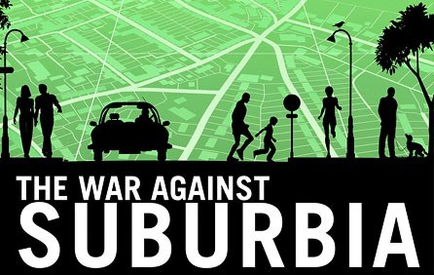
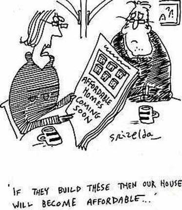
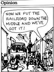
So, What Does This Mean To YOU?
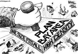
Plan Bay Area is high density housing. It concentrates 77% of all new housing into only 5% of the land area. These are known as "Priority Development Areas" or PDAs. There are numerous PDAs designated for Sonoma County (see Chart & Map pages for details).
Plan Bay Area is high density housing. It concentrates 77% of all new housing into only 5% of the land area. These are known as "Priority Development Areas" or PDAs. There are numerous PDAs designated for Sonoma County (see Chart & Map pages for details).
plan bay area is...